

 |
 |
 |
 |
 |
 |
 |
 |
 |
 |
 |
 |
 |
||||
National Parks
- George Brown Darwin Botanic Gardens
- Charles Darwin National Park
- Casuarina Coastal Reserve
- Holmes Jungle Nature Park
- Berry Springs Nature Park
- Howard Springs Nature Park
- Fogg Dam Conservation Reserve
- Manton Dam Recreation Area
- Litchfield National Park
- Leliyn (Edith Falls) National Park
- Tjuwaliyn (Douglas) Hot Springs Park
- Umbrawarra Gorge Nature Park
- Kakadu National Park
- Nitmiluk (Katherine Gorge) National Park
- Cutta Cutta Caves Nature Park
- Elsey National Park
- Keep River National Park
George Brown Darwin Botanic Gardens
Located 2 km North of Darwin’s City Centre the
42 hectares of garden feature superb orchids, ferns, figs and a wide variety
of palms. The lower entrance of the park situated on Gardens Road features
a water fountain, floral displays, a playground, barbeque and toilets.
While the higher entrance off Geranium Street has the display gardens,
information centre and plant display house. The gardens have different
landscapes including escarpment, rainforest, woodland, wetland, coastal
plain and mangroves. Aboriginal garden walks are also available to offer
an entirely different perspective on Top End plant communities. The gardens
make a relaxing day out for the whole family or for the individual who
appreciates the delicate features of the gardens. ![]()
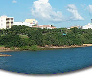
Charles Darwin National Park
Charles Darwin takes in part of the Port Darwin wetland,
one of Australia's most significant wetlands. Port Darwin is large at
48 sq km and very diverse. The national park includes a system of inlets,
islands and bays in which thirty six of the Northern Territory's fifty
one mangrove species lye. The Park is situated on Frances Bay in Port
Darwin and includes the western bank of Sadgroves Creek, Reichardt Creek
and part of Bleesers Creek. The area was part of a network of military
sites established during the development of Darwin as Australia's World
War II defence line. The bunkers and shelters in the Park were used for
storage between 1941 and the mid 1980's. The park includes a Lookout platform
where there are wonderful views of the harbour and its wetlands. There
are also walking tracks, barbecues, shade shelters, drinking water and
toilets available. ![]()
Casuarina Coastal Reserve
Casuarina Coastal Reserve lies along the coast of Darwin's
northern suburbs. The large coastal area extends from the mouth of Rapid
Creek to Lee Point and is situated 15km north of Darwin’s CBD. The
long white sandy beaches surrounded by Casuarina trees, and beautiful
sandstone cliffs make the area unique, back from the beach and sand dunes
are mangroves, monsoon vine thickets and paperbark forests and an abundance
of wildlife. The Reserve also boasts World War II artillery observation
posts, which provide a reminder of the area's wartime involvement. The
Reserve can be entered via Rapid Creek Foot Bridge, Trower Road (Brinkin)
or at the end of Lee Point Road. Barbecues, tables and plenty of shade
surround the area and make the Reserve a popular picnic spot.![]()
Holmes Jungle Nature Park
Out the back of Darwin's northern suburbs, Holmes Jungle
protects one of the few remaining areas of monsoon forest in the Darwin
region. Large numbers of wildlife inhabit the park and live in the monsoon
forest, with the dense vegetation offering protection from the heat and
predators. The Park covers 250 hectares and has a creek running through
the centre. From the main picnic area there are panoramic views of the
wetlands to the north, monsoon forest to the east and undulating ridges
and savanna woodlands to the south. The lower picnic area provides easy
access to Palm Creek. There is a walking track throughout the Park, the
Jungle Walk winds along Palm Creek and through the monsoon forest. A further
section of track connects the Jungle Walk with the main picnic area. ![]()
Berry Springs Nature Park
Berry Springs provides an attractive area close to Darwin
for recreational activities, and also provides a refreshing swimming spot.
The Park includes a large part of the Berry Creek catchment. Berry Creek
starts from a number of springs, forms a small creek, then reaches Darwin
Harbour through a mangrove lined estuary. Berry Springs has many shady
pools for swimming and several areas along Berry Creek have steps for
easy access. There are picnic areas, walking trails and wildlife in the
Park and small native fish and other aquatic life that live in the area
can be seen in the clear pools. There is a lovely loop walking track which
takes you through two different Top End habitats, it starts from the picnic
area and is good for bird watching. There is no swimming in the area,
as esturine crocodiles inhabit these waters.![]()
Howard Springs Nature Park
Howard Springs is located 37 km south of Darwin. The
park is situated on 283 hectares of diverse habitats including monsoon
forests, extensive swamps and riverine areas. Many wildlife habitats are
also visable in the area. Howard Springs has lots of shady picnic areas
with access to a beautiful spring-fed swimming pool, a monsoon forest
also surrounds the Park. There are a couple of walking trails within the
park, one of which will take you through dense rainforest to the springs
which feed the main pool. There is also an array of wildlife on the lawns
near the main pool and a variety of fish including Barramundi, can be
seen from the weir wall.![]()
Fogg Dam Conservation Reserve
Fogg Dam Conservation Reserve provides a haven for local
wildlife amongst Outer Darwin. The Adelaide River catchment is one of
several connected catchments which make up the Top End wetlands. These
wetlands have international significance because of their beauty, natural
systems and importance to Aboriginal people. The wetlands surrounded by
rainforests and paperbark swamps, attract many water birds and bird watching
early in the morning or at dusk is the main attraction of the Park. Fogg
Dam has four separate walking trails each very different and unique. The
Woodlands to Waterlily Walk leads you through forests that fringe the
floodplains. A boardwalk then takes you onto the Dam. The Monsoon Rainforest
Walk winds its way through a variety of habitats, including monsoon and
paperbark forests, and then onto the floodplains. The Dam Wall Walk has
shaded viewing platforms available along the way. And the Pandanus Lookout
has wonderful views of the Dam, great for sunset or sunrise viewing. The
Reserve is 52 km east of Darwin along the Arnhem Highway.![]()
Manton Dam Recreation Area
Manton Dam is a popular, safe, recreation area, it is
a pleasant destination and is an easy day trip from Darwin. Picnic and
barbecue facilities are situated amongst lawns and large shady trees,
an area of the Dam is set aside for swimming, fishing is permitted in
the Dam, power boats and water skiing is popular at the Dam and an Unrestricted
Boating Zone is set aside for these activities. There is a separate zone
for Low Speed Boating and Canoeing and Windsurfing are also catered for
in the Low Speed Zone. All craft must carry required safety equipment.
![]()
Litchfield National Park
The small town of Batchelor is the gateway to Litchfield
National Park. Numerous permanent waterfalls cascade down an outstanding
sandstone plateau called the Tabletop Range. There are many beautiful
swimming spots, lookouts, walking trails, picnic and camping areas in
the park. There are also a series of magnetic termite mounds to be found
in the area. Litchfield National Park is situated 100 kilometres south
- west of Darwin. The National Park has four main waterfalls which run
along the edge of the Tabletop Range and its surrounding rainforests.
The four falls are Florence Falls, Tolmer Falls, Wangi Falls and Tjaynera
Falls (Sandy Creek). Wangi Falls are the most popular as there is a constant
water flow all year round and good swimming in the area. Buley Rockhole
is also a popular swimming spot. Swimming and camping is permitted at
all falls except for Tolmer. The best time to see the falls and get around
the park easily is in the dry season from May to October.![]()
Leliyn (Edith Falls) National Park
Leliyn is a picturesque waterhole and is a favoured
stopping point for visitors travelling north from Katherine, south from
Darwin or west from Jabiru / Kakadu. Edith Falls are accessed most easily
by driving 40 kilometres north from Katherine and then following the sealed
access road for 20 kilometres. Park Facilities at Leliyn (Edith Falls)
include a fully serviced campground with toilet and shower facilities,
unpowered sites only and a picnic ground with gas barbecues and tables.![]()
Tjuwaliyn (Douglas) Hot Springs Park
Douglas Hot Springs are situated on the Douglas River,
where thermal pools create an oasis in the surrounding dry woodland. The
waters attract a wide variety of birdlife and mammals. Swimming and relaxing
in the warm waters where the Hot Springs join the Douglas River is very
popular. There are walking trails which follow the creek bank around to
the hot springs fence line or along the Douglas River where you can enjoy
the riverine wildlife. The park has a large camping area with pit toilets,
barbecues, firewood, picnic tables and water. ![]()
Umbrawarra Gorge Nature Park
Umbrawarra is a beautiful isolated gorge with steep red
cliffs. At certain times of the year there is a creek running through
the Gorge. A walking track winds along the creek to a large pool with
a small sandy beach. The rest of the gorge can only be reached by wading,
swimming and / or rock hopping. On the Gorge walls some Aboriginal art
can be seen and a short distance from the gorge entrance is a small campground
with a pit-toilet. The rocky outcrops, pools and small sandy beaches provide
beautiful swimming spots, there is also an easy 1 km walk which leads
in to the gorge and there are magnificent views of the surrounding area
from the cliff tops of the Gorge.![]()
Kakadu National Park
South East of Darwin, Kakadu National Park is a World
Heritage listed area for both its significant natural and cultural importance.
Kakadu is a cultural landscape that covers almost 20,000 square kilometres.
The park is really diverse and contains several species of birds, reptiles,
frogs and insects. More than a third of the Top End's plant life also
inhabit the area. Kakadu’s pristine landscape incorporates vast
flood plains, large billabongs, dense woodlands, lush wetlands, rivers,
rocky escarpments and plummeting waterfalls. Kakadu is also rich in ancient
Aboriginal rock art.![]()
Nitmiluk (Katherine Gorge) National Park
The 292,008 hectare National Park is located 30km north
east from the town of Katherine. The park features include spectacular
dissected sandstone country, broad valleys and numerous, significant cultural
sites. The Gorge has been carved through the ancient sandstone of the
Arnhem Land plateau by the Katherine River and is the main attraction
within the Park. Katherine Gorge is one of the Top End’s major National
Parks and is a very popular tourist attraction. A variety of boat cruises
and scenic flights allow you to experience the wonders of the magnificent
gorge system. There are also numerous walking trails throughout the park
which offer different experiences in the rugged surrounds. There are also
canoes available for hire, a picnic area with gas barbecues, tables and
toilets, a fully serviced campground with powered sites and the Nitmiluk
Centre which has, interpretive displays, a cafeteria, souvenir shop and
tour booking desk.
![]()
Cutta Cutta Caves Nature Park
Cutta Cutta Caves Nature Park is 30 Kilometres South
of Katherine and covers 1499 hectares of limestone (Karst) landscape.
Spectacular features such as Karst formations and complex cave networks
are an attraction of the park. In the park you can join guided tours
of
the cave system, walk the surrounds or view the wildlife. The 'Tropical
woodland' walk begins near the carpark and enables visitors to experience
the open tropical woodland at first hand.
There is a small kiosk in the park which sells tour tickets, refreshments
and souvenirs. Toilets and covered seating is also provided in the park.
The cave environment is home to a variety of wildlife that inhabit the
area. The harmless brown tree snake, cave-dwelling bats, ghost bats,
the
orange horseshoe-bat, shrimp and birds including the Hooded parrot and
the endangered Gouldian finch can all be seen. The park is dominated
by
open woodland however at the entrance to the cave systems and covering
some areas of limestone are unique clusters of tropical rainforest /
vine
thicket. These scattered thickets are the remains of rainforests which
once covered the northern parts of Australia. The most striking feature
of this habitat is the native fig, the caves provide an easy passageway
for the figs long roots to reach the water table. ![]()
Elsey National Park
The scenic Roper River begins its life within the boundaries
of the 13840 hectare Elsey National Park. Numerous springs within the
park feed the Roper River, which flows gently through large waterholes
and then tumbles over rocks and tufa dams. A major attraction to visitors
is the Rainbow Spring and Thermal Pool sectors of the park. The spring
water rises from underground at 30.5 million litres per day and is kept
at a constant temperature of 34°c it is then contained in a relaxing
swimming pool surrounded by a paperbark and palm forest. An established
campground, suitable for tents and caravans is located in the park. The
campground offers grassed areas, hot water and ablution facilities. The
springs of the park provide excellent opportunities for swimming and facilities
are provided at Bitter Springs and the Thermal Pool, swimming is also
possible at various areas along the Roper River. A 1.5 kilometre Botanical
walk is located in the park, there is also a 4 kilometre (one way) walk
to Mataranka Falls. The park also includes a number of short riverside
walks and a short loop walk is available at Bitter Springs. Picnic areas
complete with tables, wood, barbecues and toilet facilities are provided
at locations throughout the park. ![]()
Keep River National Park
Keep River is located 468 kilometres west of Katherine
and runs alongside the NT / WA border. The National Park is noted for
its striking landforms and provides excellent opportunities for bushwalking,
photography and the chance to learn about geological events that have
shaped the surrounding landscape. In the rocks and landforms of the region
you can view past evidence of volcanic activity, massive marine deposits
and glaciation. From several of the parks camping areas, visitors can
explore the rugged and dissected terrain of sandstone formations and view
the wildlife that inhabit the area. The park also contains many Aboriginal
Art Sites which make interesting viewing and there are a number of long
or short walks throughout the park. Two camping areas have been provided
within the park: Gurrandalng, located 15 km from the park entrance and
Jarrnarm, located 28km from the park entrance. Camping facilities include
tables, barbecues and pit toilets.![]()
| [an error occurred while processing this directive] |
|
[an error occurred while processing this directive]
[an error occurred while processing this directive]


